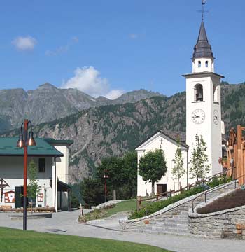
Maps of Chamois
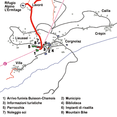
Map of Chamois,
with its villages ("hameaux") and main services.
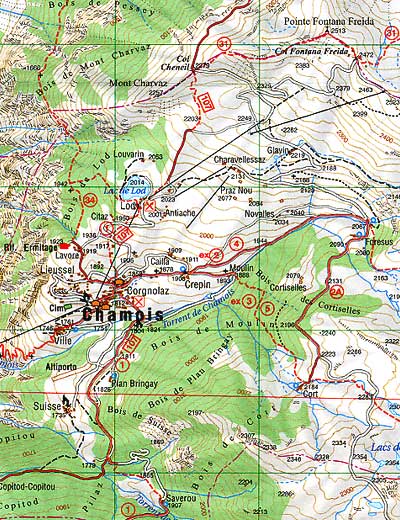
Map of Chamois Valley.
© L'ESCURSIONISTA di Zavatta Luca e C. s.a.s.
The image above is a detail from Carta dei Sentieri n. 7 - Valtournenche, Monte Cervino in scale 1:25.000, with topographic grid UTM ED1950, published by L'ESCURSIONISTA di Zavatta Luca e C. s.a.s., Via Mario Capelli, 21 - 47900 Rimini.
This detail has been published on this website thanks a courtesy by
L'ESCURSIONISTA di Zavatta Luca e C. s.a.s., who retains all copyrights.